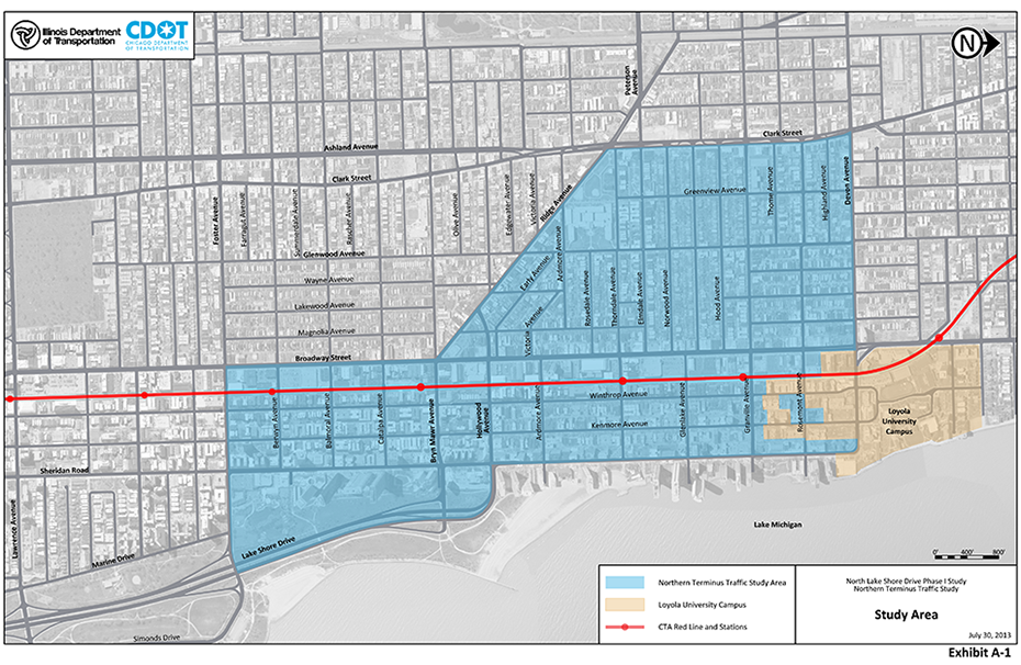
Study Description
The Northern Terminus Traffic Study area is approximately 1.5 square miles generally bound by Foster Avenue on the south, Ashland Avenue/Clark Street on the west, and Devon Avenue/Sheridan Road on the north.

The heavy travel demand inherently contributes to mobility, accessibility, and safety issues within the Edgewater community area. The rebalancing of transportation needs may be achieved by better managing North DuSable Lake Shore Drive traffic as it filters through the neighborhood.
The NTTS will collect and analyze traffic patterns to and from the northern terminus. With this information, the NTTS will identify and evaluate potential improvement strategies to better direct and control traffic flows and analyze the impact of each of these strategies on all users as well as on the neighborhood as a whole.
The NTTS will investigate the following broad types of strategies, the number and types of which will be refined based on input from stakeholders:
- Reconfigure the Northern Terminus and/or Other Neighborhood Streets - This strategy would discourage through traffic by removing or narrowing travel lanes where possible, installing curb bump-outs, and allowing on-street parking, among other traffic calming measures. Since this would result in traffic dispersing to other areas, the potential effects of this traffic dispersion would also be evaluated.
- Enhance Pedestrian Safety and Circulation - This strategy would enhance pedestrian safety and circulation at strategic locations within the neighborhood by evaluating advance pedestrian walk phases at traffic signals, retiming traffic signal systems to prohibit high speed travel, installing pedestrian grade separations at high volume intersections, or employing other strategies as summarized in the Chicago Pedestrian Plan.
- Enhance Bicyclist Safety and Circulation - This strategy would enhance bicyclist safety and circulation throughout the neighborhood by recognizing the proposed network as contained in the Chicago Streets for Cycling Plan 2020, evaluating other bicycle planning initiatives underway in the 48th Ward, and incorporating design elements contained in the associated Streets for Cycling Bicycle Facilities Guide which is part of the Chicago Cycling Plan.